Koszyk
0
Produkt
Produkty
(pusty)
Brak produktów
To be determined
Wysyłka
0,00 zł
Razem
Produkt został dodany do Twojego koszyka
Ilość
Razem
Ilość produktów w koszyku - 0
Masz 1 produkt w koszyku.
Koszt produktów
Koszt wysyłki
To be determined
Razem
Filtruj
Kategorie
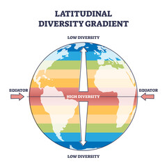
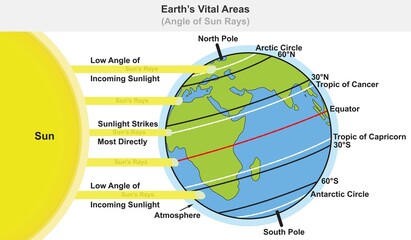
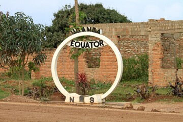
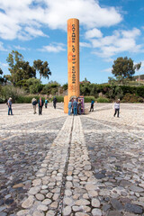
Wyniki wyszukiwania równik
-
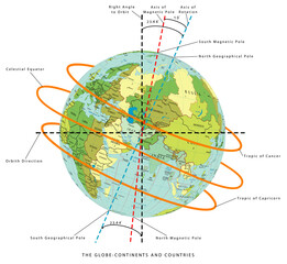
#680240563

-
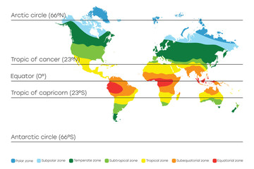
#519389841
-
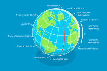
#666459615

-
#634392777

-
#710782097

-
#767694539

-
#564001365
-
#508115998
-
#269511790

-
#438483717
-
#272722761

-
#678999377

-
#63860627

-
#485586099
-
#437623125

-
#506812220
-
#458132061
-
#150710183

-
#472772985
-
#453405910
-
#219960942

-
#325418109
-
#603766011
-
#477227876

-
#185893563